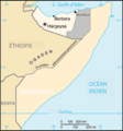
Fichier:Somaliland-map-fr.png
Apparence
Somaliland-map-fr.png (330 × 355 pixels, taille du fichier : 21 kio, type MIME : image/png)
Mokóló mwa kásá
Cliquer sur une date et heure pour voir le fichier tel qu'il était à ce moment-là.
| Mokɔlɔ mpé ntángo | Miniátilɛ | Dimasió | Mosáleli | Ntembe | |
|---|---|---|---|---|---|
| ya sikáwa | 20 yúni 2020 à 18:19 |  | 330 × 355 (21 kio) | Chipmunkdavis | Reverted to version as of 13:13, 29 November 2006 (UTC) Dispute already indicated on map |
| 20 yúni 2020 à 16:24 |  | 330 × 355 (19 kio) | Meelpringthusss | see ongoing discussion at File_talk:Somalia_map_states_regions_districts.png#There_is_nuance_with_regards_to_control | |
| 20 yúni 2020 à 09:12 |  | 330 × 355 (21 kio) | Bboyfbg | Reverted to version as of 13:13, 29 November 2006 (UTC) | |
| 17 yúni 2020 à 23:57 |  | 330 × 355 (19 kio) | Meelpringthusss | added disputed area | |
| 29 novɛ́mbɛ 2006 à 13:13 |  | 330 × 355 (21 kio) | Kimdime | {{Information |Description = Map of Somaliland |Source = Adapted from the CIA map [http://www.odci.gov/cia/publications/factbook/maps/so-map.gif], but showing the other parts of Somalia not as a different country. |Date = |Author = United States Federal G |
Bikangisele bya kásá
La page suivante utilise ce fichier :
Usage global du fichier
Les autres wikis suivants utilisent ce fichier :
- Utilisation sur kg.wikipedia.org

