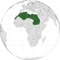
Fichier:North Africa (orthographic projection).svg

Taille de cet aperçu PNG pour ce fichier SVG : 600 × 600 pixels. Autres résolutions : 240 × 240 pixels | 480 × 480 pixels | 768 × 768 pixels | 1 024 × 1 024 pixels | 2 048 × 2 048 pixels | 733 × 733 pixels.
Fichier d’origine (Fichier SVG, nominalement de 733 × 733 pixels, taille : 161 kio)
Mokóló mwa kásá
Cliquer sur une date et heure pour voir le fichier tel qu'il était à ce moment-là.
| Mokɔlɔ mpé ntángo | Miniátilɛ | Dimasió | Mosáleli | Ntembe | |
|---|---|---|---|---|---|
| ya sikáwa | 6 dɛsɛ́mbɛ 2020 à 16:59 |  | 733 × 733 (161 kio) | M.Bitton | Reverted to version as of 01:02, 16 November 2019 (UTC): North Africa is a group of countries that are separated by borders |
| 6 dɛsɛ́mbɛ 2020 à 16:20 |  | 501 × 501 (196 kio) | Taha Khattabi | Centered Projection. Added Sinai Peninsula in light green because it is politically part of Africa (Egypt). Sudan in light green because it's considered as East Africa by the AU. If anybody can thicken the borders in the green countries and re-upload that would be great. | |
| 16 novɛ́mbɛ 2019 à 01:02 |  | 733 × 733 (161 kio) | Afrogindahood | Excluded Sinai peninsula which is a part of Asia | |
| 30 dɛsɛ́mbɛ 2018 à 14:15 |  | 550 × 550 (123 kio) | Wadaad | UN geoscheme and the most common understanding of the term. | |
| 21 dɛsɛ́mbɛ 2012 à 03:39 |  | 550 × 550 (167 kio) | Spacepotato | Recolor South Sudan, since in the current version of the UN geographic classification scheme, http://unstats.un.org/unsd/methods/m49/m49regin.htm , South Sudan has been placed in Eastern Africa. | |
| 25 sɛtɛ́mbɛ 2011 à 17:02 |  | 550 × 550 (168 kio) | Night w | adding back s.sudan under un def.; adding back saharan countries under geo def. | |
| 19 augústo 2011 à 20:58 |  | 550 × 550 (167 kio) | Yabroq | Thickened borders | |
| 19 augústo 2011 à 16:35 |  | 550 × 550 (167 kio) | Yabroq | Removed South Sudan. Removed West and Eastern Africa Which is not North Africa | |
| 15 yanwáli 2010 à 02:11 |  | 550 × 550 (172 kio) | Connormah | {{Information |Description={{en|1=North Africa }} |Source=Based off File:Africa (orthographic projection).svg, File:LocationNorthernAfrica.png |Author=Connormah |Date= |Permission= |other_versions= }} |
Bikangisele bya kásá
La page suivante utilise ce fichier :
Usage global du fichier
Les autres wikis suivants utilisent ce fichier :
- Utilisation sur af.wikipedia.org
- Utilisation sur am.wikipedia.org
- Utilisation sur ar.wikipedia.org
- Utilisation sur azb.wikipedia.org
- Utilisation sur az.wikipedia.org
- Utilisation sur bn.wikipedia.org
- Utilisation sur br.wikipedia.org
- Utilisation sur ckb.wikipedia.org
- Utilisation sur da.wikipedia.org
- Utilisation sur diq.wikipedia.org
- Utilisation sur el.wikipedia.org
- Utilisation sur en.wikipedia.org
- Utilisation sur en.wiktionary.org
- Utilisation sur fa.wikipedia.org
- Utilisation sur fi.wikipedia.org
- Utilisation sur ga.wikipedia.org
- Utilisation sur gv.wikipedia.org
- Utilisation sur hi.wikipedia.org
- Utilisation sur ht.wikipedia.org
- Utilisation sur hu.wikibooks.org
- Utilisation sur ilo.wikipedia.org
- Utilisation sur incubator.wikimedia.org
- Utilisation sur it.wikipedia.org
- Utilisation sur ja.wikipedia.org
- Utilisation sur kg.wikipedia.org
- Utilisation sur ko.wikipedia.org
- Utilisation sur lad.wikipedia.org
- Utilisation sur la.wikipedia.org
- Utilisation sur lt.wikipedia.org
- Utilisation sur mdf.wikipedia.org
- Utilisation sur mi.wikipedia.org
- Utilisation sur mk.wikipedia.org
Voir davantage sur l’utilisation globale de ce fichier.


